Grand Gulch [AAW12]
I spent five days in Grand Gulch a few years ago enjoying one of the most famous areas of the Outdoor Museum - an informal but highly respected idea that artifacts are best left where they are found in their original geography and not sitting inside display cases in a museum.
Grand Gulch is a winding canyon cut into Cedar Mesa in southeast Utah. The area is managed by the BLM and maintained as a hiker's paradise. It gets heavy usage and permits are required - even for day hikes. We reserved our permit a couple of months in advance and picked it up at the Kane Gulch Ranger Station the morning of the first day of our trip in late April. We bypassed the popular upper section of the gulch by driving down to the Bullet Canyon trailhead.

Bullet Canyon
Bullet Canyon is a side canyon of Grand Gulch and is a bit steep in spots especially with a heavy pack - I would suppose. I don't carry heavy packs. Being on the lazy side, I always carry light packs.
After a couple of hours of sauntering down the canyon we come upon the first large ruin and I am completely amazed. Yes, I knew about the ruins and artifacts. I had read the accounts of others. I had seen pictures. But, to actually walk into a such a well preserved ruin is nothing like reading about it. Sorry.
Perfect Kiva Ruin, Bullet Canyon
Silence. Just the sound of my breath. The smell of rock, dust, age. The craftsmanship of centuries old structures. Handprints in the mud used as mortar. It hits you hard that these were real people living real lives. This is no diorama in a climate controlled building. This is real.
Metates and maize at Perfect Kiva, Bullet Canyon
On one long block of sandstone there are a dozen or so metates worked into the sloping face of the rock. Women, most probably, ground corn with a mano (rock held in the hand) against the metates. Imagining them kneeling there, working side by side it is so real and immediate.
The kiva roof is intact, hence the name "Perfect Kiva" and there is a wooden ladder leading down into the kiva. Another amazing aspect of this area is that you get to actually go in to some of the ruins - and there are no lines.
Inside Perfect Kiva, Bullet Canyon
We have seen only one other group of hikers today, further up the canyon heading into another side canyon. For the hour or so that we spend at Perfect Kiva, no one else appears. It is our own for a short time. We left it the way we found it with only a few more footprints in the sand. We walk on down canyon where we come upon another ruin.
Jailhouse Ruin, Bullet Canyon
The Jailhouse Ruin gets its name from the barred window in the lower wall shown in the lower left of the above pic. The petrographs of white ghostly faces are interesting and new to me. I suppose they were fun to make but have no idea of their significance.
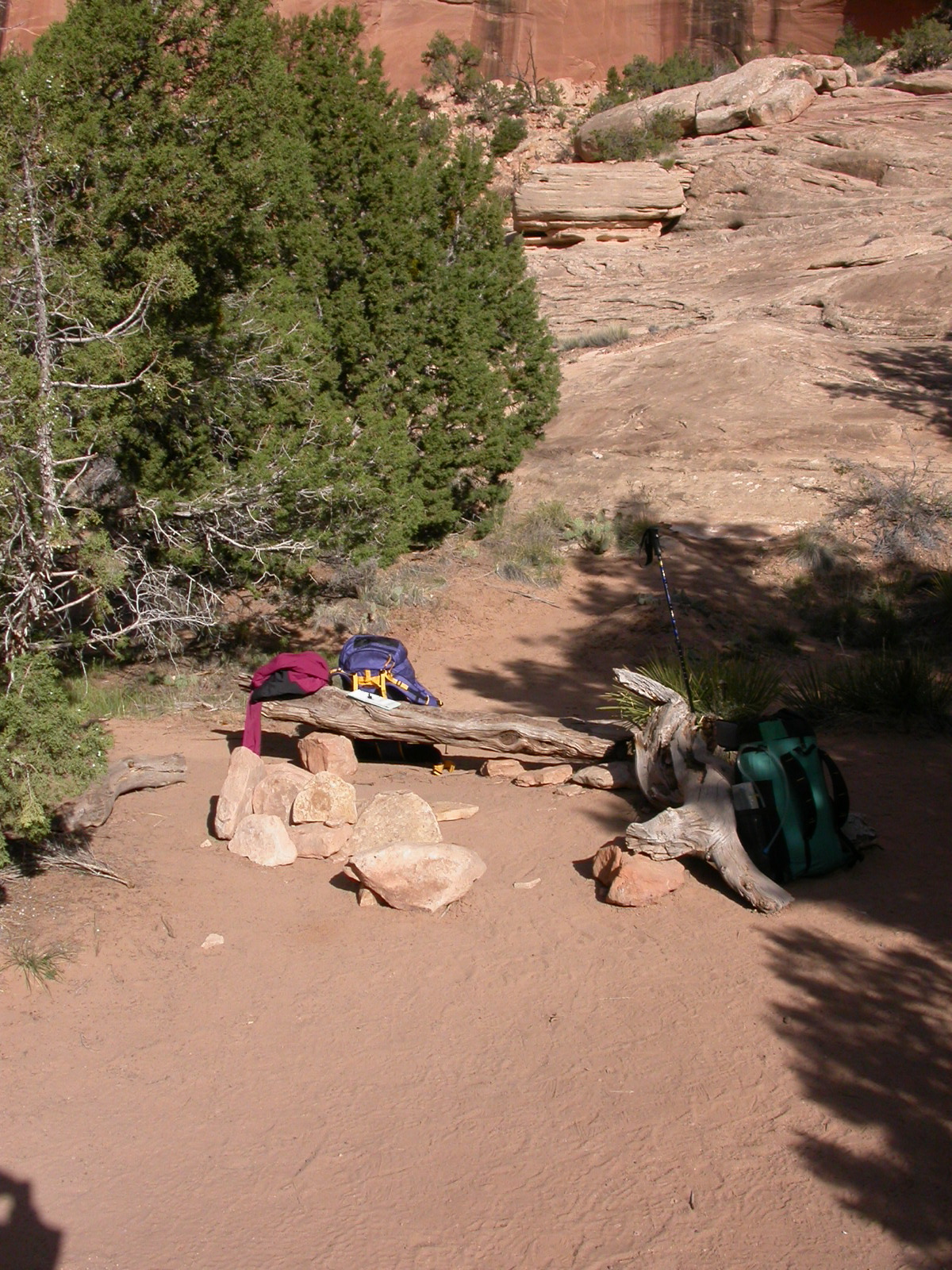
We are traveling pretty light on this trip - bivy sacks and sleeping bags, a sweater, no rain gear, and a bit of food round out the pack. I'm using a frameless rucksack with no hip belt. It weighs 11 ounces empty. It works well for light loads of 20 lbs or less. And, for all but the first and last days of the trip, we are walking in the floor of the canyon so mostly level routes. A nice easy walk in the desert in April camping wherever we are when we decide to stop for the day. Such as this nice spot someone has arranged apparently just for us in the vicinity of the Jailhouse ruin.
We make a right turn at the mouth of Bullet Canyon and head up Grand Gulch proper then another right into Shieks Canyon were we come upon a petrograph panel that has mostly human figures without heads.
It is always dangerous to try to speculate what is going on here. Could be anything. My inclination is the artist just never made it back to finish his work. But, I have no way of knowing if all the figures were drawn at the same time or over a period of 1,000 years. Maybe the significance of the drawings is sufficient without the heads.
The most famous petrograph in Shieks Canyon and one of the more unusual in Grand Gulch is the Green Mask.
Somewhat faded over the years but still a striking bit of artwork.
Back down the canyon we stroll with occasional stops to check out ruins and petrograph panels. The weather is warm with mid afternoon sun warm enough to work up a sweat - if one is careless enough to work that hard. Instead, we find shady spots for lunch and snacks and contemplation of the color and texture of the canyon country.
The water situation is sparse but sufficient. We are turned back from one side canyon that reportedly has a spring because of the dense tamarisk growth at its mouth. Completely impenetrable. We filter all we drink and usually find seeps and springs like this flowing from a side canyon.
We come upon Cactus Garden Ruin and see some different petrographs on the walls above the ruins. Apparently birds were the topic on this artists mind. I can't tell what kind of birds he or she may have been trying to represent - maybe it was not a species but all birds.
We have chosen a less traveled route in the middle to lower section of Grand Gulch and so far have seen only three other groups of 2-3 humans. One of the attractions of this stretch of canyon is the Big Man petrograph panel seen here on the approach from the bottom of the canyon.
A quick scramble up to the panel itself shows that it would be more correctly titled "Big Woman and Big Man" Panel.
This are impressive figures - sorry that I did not get a person in there for scale. But, they are definitely big. We spent an hour or so with them. They are beautiful but provided no data pertaining to why they exist. I'll just stick with beautiful. The exist for their own sake and the sensitivities of the artist(s).
Like most canyon country hiking, there are no maintained trails per se in Grand Gulch, more like suggested routes. Many of which are easiest if one walks down the stream channel which is more of a Boulevard or a Parkway - much more than a trail. We see some recent foot prints, but no other evidence of other hikers for the rest of the trip.
The Parkway takes us to the "Big Pouroff" located in the center of the canyon.
We walk around the side and then check out the water in the pool scoured below the pouroff. Water of any significance is always worth inspection when walking in the desert. The pool is loaded with frogs.
I think there are at least five in the above pic. The water was getting a bit thick and murky. Seems to have been some time since it rained around here and evaporation was doing its job of concentrating the dissolved, and not-so-dissolved solids in the water. The pool was quite deep and the water was coolish, but we resisted the temptation to swim with the amphibians.
More desert beauty in the form of Claret Cup (red) and Prickly Pear (pink) blooms.

Near our second to last campsite we came upon an area that we named, "The Place Where They Go to Break Pots." The hill side was covered with pot sherds and rock flakes. There has been a lot of activity in that area for a long time. I have never seen an undisturbed area so thickly covered with artifacts.
I think our name for the side canyon is much better than the official name which was Rock Canyon, or Dry Creek Canyon, or Willow Canyon or Deer Canyon or some other less prosaic, utilitarian and overused name.
Another day and another leisurely stroll own the canyon. Several of the larger ruins have interpretive materials provided by the BLM in .50 cal ammo boxes at the sites. We read some of the info and sometimes did not even open the boxes. It was fine information but it was also fun to just explore on your own without a guide. This is Bannister Ruin - no doubt built by some of the very few parents who had any concern for their children falling. Maybe these parents had exceptionally clumsy kids? Most of the sites had no protection at all - at least none left in place. Perhaps this was the more common habit but the bannisters at other sites were just not preserved.
We continued down canyon until we reached the Grand Gulch Narrows. Where we turned around and headed back up canyon for our last night before walking out.
All of our previous campsites had been in the bottom of side canyons, near water and we decided to spend the rest of the afternoon up in a rincon (an abandoned meander) above the main canyon. We pumped some water and filled our containers with some of the more rank swill I've had the privilege to drink while walking in the desert then proceeded up into the rincon.
Not surprisingly, we were not the first folks to have whiled away a lazy afternoon at this location. We found this petrograph panel up in the rincon. It was nice to think that we shared the same aesthetic as the prehistoric artists in Grand Gulch.