Death Hollow across the Slickrock [AAW01]
If you've ever been to southern Utah or northern Arizona, you've seen the Jurassic Navajo Sandstone. It is commonly exposed across wide swaths of the canyon country. Most famously perhaps in Zion National Park.
The Boulder Mail Trail is a route between the towns of Escalante and Boulder, Utah once used to deliver mail between the two towns. Later the US Forest Service strung a telephone cable between the two towns along this route. Today it is a nice hiking route leading from cairn to cairn across the slick rock of the Navajo Sandstone. These pictures are from a walk along the northern portion of the route in May 2014.

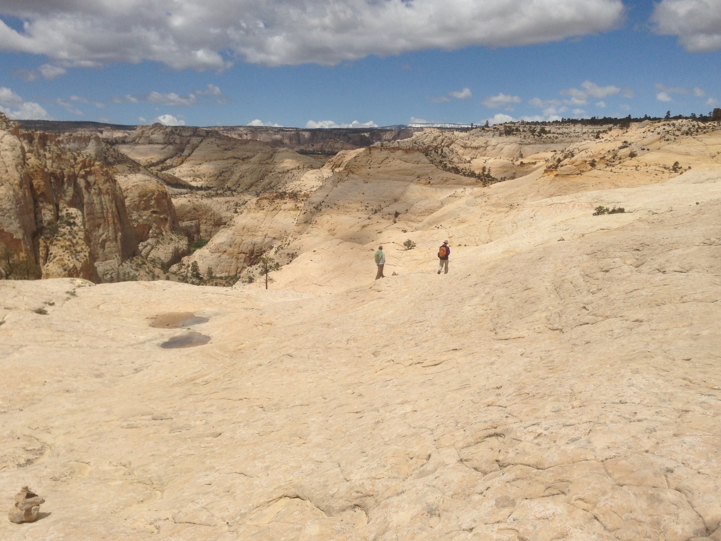
The Mail Route to Death Hollow across the Navaho Sandstone slickrock with cross-bedding evident in the bedrock
The angular lines in the bedrock in the picture above are called cross-bedding and are evidence that the sands composing the bedrock were deposited in sand dunes. The Navajo Sandstone consisted of more than 100,000 square miles[2] of sand dunes in Jurassic time - approximately 145 to 200 million years ago. The Jurassic Navajo Sand Sea, or Erg was an impressively large sandbox for dinosaurs. A Navajo gentleman, with a big grin on his face, once pointed out the location of dinosaur tracks preserved as trace fossils in the rocks of the Navajo Sandstone as we traveled a dusty road through the reservation in his pickup. A nice bit of local pride.
Boulder-Escalante Mail Route above Death Hollow
Our walk started just across the runway at the Boulder "airport" which is about as simple, and ominous, as any "airport" I've seen with a sign painted on the wrecked fuselage of an airplane.
Boulder Airport - note cable in foreground used to tie down aircraft in the "Airplane Parking" area.
We left the trailhead and proceeded across the plateau for a couple of miles before coming out on the Navajo Sandstone bench. The route crosses a lesser canyon, over a divide and then one is presented with Death Hollow. The view from above seems impossibly steep but ledges and gentle slopes lead progressively deeper into the bedrock. As usual, canyon walls look much steeper from a distance or looking straight on - but once you start the descent, it is not bad at all - as long as you stick to the marked route. Although commonly stated, descending into a canyon is not like climbing a mountain in reverse. It is completely different. It is entering the earth, walking down into the rocks composing the crust of the earth. The very nature of the act makes anyone, at least for the duration of the canyon walk, a geologist.
The bottom of Death Hollow is surprisingly lush in this area likely due to the apparently perennial stream. Large ponderosa pines (reeking of vanilla or strawberry - really, give them a sniff!) are the climax species with a mixture of shrubs (predominantly alder and poison ivy) filling out the underbrush.
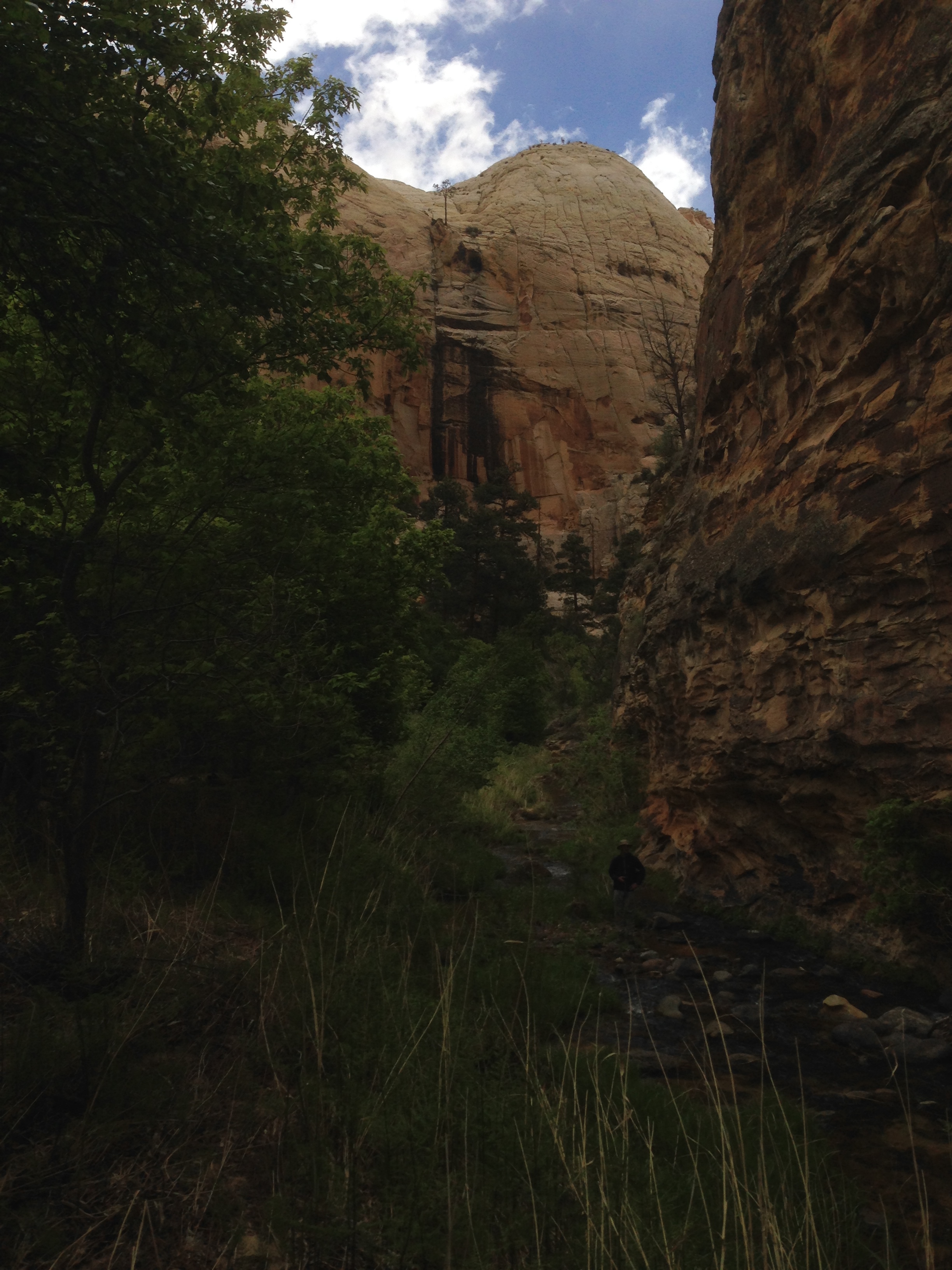
The bottom of Death Hollow
A bit of exploration involving repeated creek crossings, some lunch and a rest on a sandbar by the creek and then the climb back out of Death Hollow. Climbing out provides a much closer-up view of the rock itself. At times my nose is only a couple of feet from the rock. Sand is weathering out of the sandstone - as you would expect. The sand blows with the breeze and flows with precipitation runoff collecting in sheltered areas and begins to resemble its historic habit of dunes.
Sand dunes temporarily resting on Navajo Sandstone with cross-bedding from Jurassic sand dunes above Death Hollow. Photo credit: T. Ramsden.
The sand dune in the foreground is composed predominantly (95% or more by my guess) of quartz grains. The quartz grains began their geologic history by crystalizing out of molten rock. The crystals formed in granites or granitic like rock underground. The granitic plutons with our relatively young quartz crystals were then exposed at the surface of the earth after millions of years of cooling, uplift and erosion. They were broken up into pieces through freeze-thaw and other mechanical processes and transported by wind and water to areas where winds sorted out the small to medium sized grains and started piling them up into dunes. Other quartz grains were provided by other rock types - sandstone would be a likely source.
The Navajo Sandstone is 1,100 to 1,500 feet thick in this area.[1] More than a thousand feet thickness of sand covering more than 100,000 square miles. Try to get your head around that. Just try.
Imagine a 1,000-mile strip of sand dunes that is 100-miles wide. There has to be some local geographic reference you have for 100 miles. For me it is the distance between Denver, Colorado and Cheyenne, Wyoming. A thousand mile reference is probably a bit harder to come up with. Again, for me, it is the distance between Denver and Chicago. A strip of sand dunes as wide as the distance between Denver and Cheyenne running all the way from Denver to Chicago with an average thickness of 1,300 feet. Staggering. But, you can start to get an idea of the immensity (if not the exact geometry) of the sand sea. Now, double the area and maybe triple the area and then increase the thickness by 75%. That is the area and thickness (what you geometry majors may think of as a "volume") of what some hypothesize as the original size of the sand sea.[2]
The dunes existed for tens of millions of years during the Jurassic and were then buried and lithified or transformed from sand into sandstone with the original depositional texture of cross-bedding indicative of dune deposition still intact. The individual sand grains were cemented together by groundwater percolating through the buried sand and depositing silica and sometimes calcium carbonate in the interstices between grains. The bits of igneous quartz crystals and bits of quartz crystals from other rock sources, remained buried for more than 100 million years. Then around 20 million years ago[3] uplift of the Colorado Plateau increased erosion and today we have the Navajo exposed at the surface and it is actively forming sand dunes again as it erodes away.
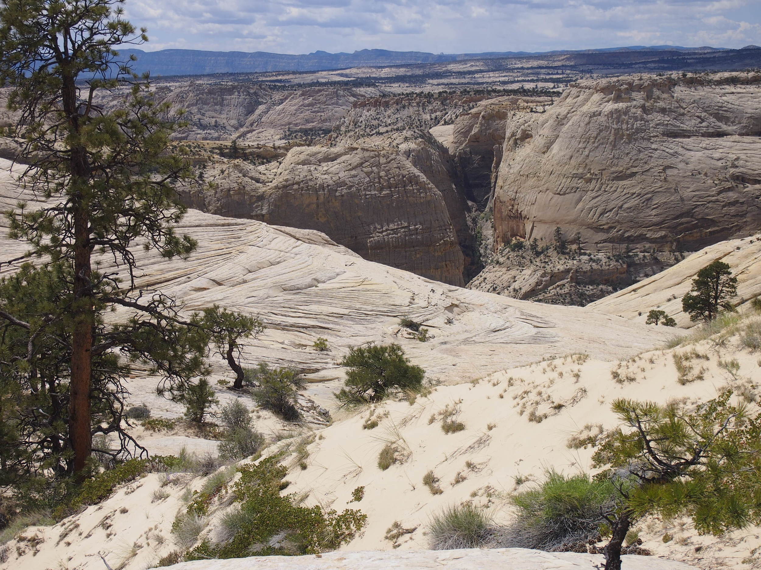
It also provides some of the more spectacular erosional landforms. The beauty of which is only increased by the knowledge of what it is and how it came to be.
Erosional landforms exposing cross-bedding in sandstone and recent dune sand, Navajo Sandstone, Boulder Mail Trail.
[1] Geology of Grand Staircase-Escalante National Monument, Utah: http://www.blm.gov/pgdata/etc/medialib/blm/ut/grand_staircase-escalante/programs/geology.Par.35407.File.dat/Geology%20of%20GSENM.pdf
[2] Wikipedia entry for Navajo Sandstone accessed 10/13/2014: http://en.wikipedia.org/wiki/Navajo_Sandstone
[3] Wikipedia entry of Golorado Plateau: http://en.wikipedia.org/wiki/Colorado_Plateau#Geology